As the 10-year anniversary of the 2004 Boxing Day earthquake and tsunami approaches, an Australian expert says it is a little known fact that the effects were felt as far away as South Australia.
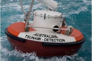
A tsunami detection buoy is part of Australia’s early warning detection network. (Supplied: Bureau of Meteorology)
By: Michael Sutton
Abnormal currents and ocean tides found their way around Australia’s south-western tip from an earthquake epicentre about 3,000 kilometres away off the coast of Sumatra.
The earthquake was so powerful it buckled more than 1,200 kilometres of ocean floor by up to 10 metres and released the energy of about 20,000 atomic bombs.
The earthquake and tsunami combined killed up to 230,000 people across southern Asia.
Tasmania also received “signals” from the tsunami, and in Western Australia about 35 swimmers needed to be rescued from dangerous currents and rips.
The head of the Tsunami Warning and Ocean Forecasting Services at the Bureau of Meteorology (BOM), Rick Bailey, said Hillarys Boat Harbour in Perth was hit by a 40-centimetre amplitude wave that was 80cm high.
“There was a lot of damage to boats in marinas and things, all the way around to Tasmania, such as surges, boats being jammed up under the jetties, and similar damage,” he said.
“Eventually, just over a day later, the wave effects got right into the south-east Pacific and also right around into the Atlantic, so it spread a fair way.”
Australia’s west and east coasts most vulnerable
Mr Bailey chairs the United Nations intergovernmental group that set up the Indian Ocean Tsunami Warning System after the 2004 natural disaster.
He said about 85 per cent of tsunamis were caused by subductive earthquake events – when one tectonic plate moved under another.
It resulted in the buckling of the sea floor, which in turn resulted in the mass displacement of water.
Tectonic plates in the Indian and Pacific oceans to the west and east of Australia meant WA and the eastern states were most vulnerable to any major land inundation.
Below SA, however, the plates moved laterally and were unlikely to cause major water displacement, meaning tsunamis that reached SA were likely to have very little impact.
“In 2006 there was a 7.6-magnitude earthquake south of Java,” Mr Bailey said.
“A campsite in WA was flooded and a four-wheel drive on the beach was moved by the surge. Again, we could see the signal, albeit a very small signal, getting around to SA, and the big earthquake in Chile in 1960 saw small surges reach SA.
“There’s also a trench south of New Zealand that can send some energy through to the south, but again, it’s more on a lower level.”
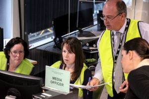
Rick Bailey works with the BOM media team during an Indian Ocean tsunami exercise. (774 ABC Melbourne: Simon Leo Brown)
Tsunami warning system in place
BOM works with Geoscience Australia to operate the Joint Australian Tsunami Warning Centre.
Mr Bailey said they had 10 minutes to analyse an earthquake, and 10 to 20 minutes to then determine what zones would be under threat from tsunamis, including in countries overseas and Australia.
“The models are so complicated that we can’t run them in real time, but we’ve done a whole lot of pre-run scenarios so we pick the model runs that match the earthquake and start watching our sea level records and deep ocean buoys and put out our warning accordingly,” Mr Bailey said.
“The bigger the earthquake, the bigger the sea floor buckling, and the more water that gets shifted around.”
BOM has recently updated and re-issued media guidelines for its tsunami warning system.
It includes colour-coded messages that range from No Threat, to Watch, to Marine Warnings, Land Warning and Cancellation.
BOM said tsunamis were recorded in Australia about once every two years, but most were small and presented little threat of land inundation.
“That’s why we have two levels of warning, Marine Threat and Land Threat,” Mr Bailey said.
“We don’t want people panicking and evacuating from the coastline, but we do want to make it known that for the Marine Threat, dangerous currents can happen that could affect marine industries and people swimming.
“For example, after the biggest earthquake ever recorded in the 1960s, in Chile, there was quite a lot of sloshing going around in Sydney Harbour and quite a lot of boats were damaged and some sunk.”
A major earthquake in 1868 in north Chile also resulted in strange tides in Sydney Harbour and Newcastle Harbour, and a jetty was washed away in Tasmania.
Warnings issued this decade
In June this year, BOM issued a warning to the Cocos Islands near Christmas Island north-west of WA following seismic activity in the south Indian Ocean.
In 2012 a threat advice bulletin was issued to countries fronting the Indian Ocean following a significant earthquake in the same region as 2004’s but further out to sea.
Fortunately the earthquake did not result in a similar buckling of the sea floor and only a relatively small tsunami was generated.
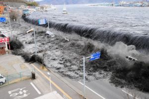
Bulletins were also issued in 2011, after the Tohoku earthquake hit Japan with a severe tsunami that killed nearly 16,000 people and left more than 2,500 missing.
“So it’s about one every one or two years,” Mr Bailey said.
“Sometimes if it’s quiet we get more worried because that means pressure is building up somewhere.”
The 2011 Japanese tsunami inundates a street in Miyako city, Iwate prefecture. (Mainichi Shimbun:Reuters)
http://www.abc.net.au/news/2014-12-17/boxing-day-tsunami-effects-felt-as-far-away-as-sa/5972688


